Showing posts with label clarks valley. Show all posts

1.13.2014

general specific.

A number of want-to-go-heres and got-to-go-theres have been taking shape in this rattletrap of a head of mine, but holiday bustle and proper priorities have the fruition of those schemings waiting on another day.

Opportunistically (always), I have continued in the meantime to explore bite-sized adventures more easily digested in the snack-length windows of time available in late December/early January.  Sticking with the introduced theme and accepting the gift of mild post-Christmas weather, I went to visit a real-life rattletrap that lies mouldering a few hundred yards off of the Appalachian Trail in the St. Anthony's Wilderness east of Harrisburg.

But I'll get to that in a bit.

December had ushered in snow, melted it off, brought a bit more and then turned around and jacked up the temperatures.  On the morning of the 28th, the sun was beaming and the prognosticators were calling for the mercury to top out well over 50 degrees.  The only acceptable reason for not being out in it was putting in a few fun hours of indoor rock climbing with my wife and daughters.


While the girls headed from the gym to the movie theater for a viewing of the latest Pixar film, Mamie (a/k/a Sugar Pie) accompanied me to Clark's Valley between Peters and Stoney Mountains about 10 miles east of the Susquehanna River.  I didn't have any specific mileage in mind, but our intent was to point ourselves east, following the Appalachian Trail northbound toward and perhaps past Rausch Gap.  A couple years ago, I had come the opposite direction, starting in Swatara Gap and turning around just 4 or 5 miles shy of the parking lot from which the dog and I would be departing.  The first few miles would be a retracing of the route Jefferson and I had followed the day I ran the Horseshoe Trail from its start/finish on the top of Stoney Mountain to Campbelltown to mark my 37th birthday.  Many more miles had been logged on the AT since then, but it had continued to bug me, pettily I suppose, that those few miles in between had remained unexplored.


Mamie couldn't have cared less about what had or had not yet been covered, but she was ready to go wherever it was we were going. In the rush to get started, I had forgotten to fill the hydration bladder in my pack before leaving home, but the stream at the trailhead just off of Route 325 was running high and graciously lent a few liters of water to which I added a purification tablet before uttering the "go get 'em, girl" the dog had been patiently awaiting. 


The first 3.2 miles came and went quickly, as Sugar Pie set a brisk pace climbing the 1,000+ feet to the summit of Stoney and the intersection with the Horseshoe Trail.  Curiosity coaxed me to peek at the HT trail registry and, remembering how fun the initial descent is from there down to Rattling Run, I nearly modified our plans but shook off the temptation, nodded toward the monument that marks the terminus of the trail in a vague manner meant to indicate that I would return soon, and then jumped back on the AT for the first true ground-breaking mileage of the day.


The next section proved wonderfully runnable, tracking mostly along the top of the ridge and eventually downwards, all with little rock, comparatively, to the terrain with which I was more familiar in the miles that would come later.  There were a couple of melt-fed streams to cross and passageways of rhododendron to glide through, but, except for a few slushy footprints, we had the trail to ourselves.

We clambered over the rocky gouge where an old incline used to once reside, shuttling coal from the mined shafts higher on the ridge to the waiting-to-whisk-away rail lines in the valley below.  Soon we reached the ruins of Yellow Springs Village which was abandoned in 1859 after what coal could be harvested had been depleted.  Except for some diminishing foundations and crumbling stonework, little remains besides the mailbox that has since been erected to house an AT trail registry.*


Another 5 miles would deposit us in Rausch Gap but, having heard many tales of an old stranded steam shovel (my research revealed that it's actually an early gasoline-powered shovel, but that's not nearly as aesthetically pleasing to the ear/eye) on a spur trail somewhere in between, I was strongly entertaining the idea of a side trip.  After tiptoeing through a minefield of good old Pennsylvania rocks for the next 2 miles, Mamie and I were staring at the sign that signaled the arrival of our detour.


I wasn't entirely certain how far we'd need to travel along the Sand Spring Trail to lay eyes on the General, but with only 1.7 miles from where we stood to Route 325, I figured we couldn't be looking at more than a 3 mile diversion.

The trail descended from the AT and required a rock hopping across Rausch Creek.  A two-foot-long panel of rusty metal wedged in a notch of a tree confirmed that we were still on the right track.  I was surprised to see that the trail climbed steeply soon after and it was nearly an all-fours endeavor to gain the top of the slope.  It was apparent that there hadn't been much recent foot traffic and between the severity of the grade and the leaf litter, my climbing was a pretty sloppy showing.  Reaching the high point, I expected to see this rumored shovel greeting our (my) huffing and puffing arrival.

No such luck.

Faded blue blazes announced that we hadn't managed to lose the trail but there was no sign of any ancient machinery.  Before we'd gone more than 100-200 yards, yellow blazes advertised a side trail heading in an easterly direction and I was sure that the General was waiting just around the bend.  The trail dead-ended at a Jenga-worthy stack of conglomerate rock that provided a breathtaking overlook of Second and Blue Mountains to the south.  It was a vantage point well worth reaching, but offered no sign of our quarry.


We backtracked to where we had left the Sand Spring Trail and hung a quick right to continue on our hunt.  Almost immediately, the trail aggressively gave ground, heading down into Clark's Valley quite steeply.  A few inches of snow and even ice on rocks and downed trees clung to this, the leeward side of the ridge. Sugar Pie vanished from sight while I struggled to keep feet beneath me.  The sun had fallen low in the sky over the last half hour, but it was significantly darker with the shadows cast by the ridge now rising behind us.  It didn't seem like there could be much more trail remaining before we would hit 325 and that either meant that we'd passed the General or that it rested much closer to the road than I had first believed.

A good spill was followed moments later by a second fall.  I decided that pushing on and losing any more light would likely mean having to follow the road back to where we'd parked the car as clawing our way back up this side of the ridge and then picking our way down the Sand Spring Trail again on the other side was going to be some difficult navigation after the sun had set even with the headlamp that I'd brought along.

With a whistle to cue Mamie back my direction, I began the climb back the way we had come.  The ascent worked out better than expected, mostly because I was guided by the holes I'd just punched in the snow moments before.  The amount of sunlight still available when we topped out was a pleasant surprise and the differences between either side of the ridge due solely to their positioning to sun and wind was a marvel.

Still, more light didn't mean much light and I hurried to get back down to Rausch Creek before darkness arrived.  As the hunk of metal in the tree came back into view, it became apparent where I'd made my mistake.  That metal was actually the indicator of where to turn to find the decrepit shovel.  Though there was nobody there to appreciate the gesture, I rolled my eyes at my "duh" and hustled to find what we'd come seeking.  The trail was faint and grown nearly shut with rhododendron but after following it for no more than 50 yards, I discovered the path widened considerably and soon the old machine materialized.


In the low light, the dog cowered at the sight of the once-mighty General.  The moniker, I've since learned, comes from the word now just barely visible on a rusty rear panel and the last visible remnant of the namesake General Excavator Company that manufactured the shovel.  As noted, it isn't an actual steam shovel, but considering that GEC is said to have gone out of business in the 1920's, it is a pretty impressive example of an early gasoline-powered shovel.  It rests in a slight depression and the surrounding area bears signs of the excavating that the General at one time must have been capable.  Even with evidence that it was once fully functional and put in work right where it still sits, it is hard to figure out how the General ever arrived in its perch and at least as strange to understand why it was left there.

I nosed around a bit longer and, yes, in a fit of childhood imagining, I even pictured myself operating the old shovel.  Not for long, though, as I decided to take advantage of the final moments of light to hop dryly back across Rausch Creek and return to the AT.

I checked the GPS.  We'd covered just under 10 miles and had to be another 3 miles from Rausch Gap.  My legs still felt great and Suge, no doubt, had plenty of gas in her tank, but I had been guilty on other occasions of pushing on because of feeling fine only to discover shortly thereafter that I didn't feel fine anymore and had that much more ground to cover in returning to the trailhead.  I chuckled over the fact that due to my out-and-back modus operandi, the day I can say I've traveled every inch of the Appalachian Trail in Pennsylvania is the day that I can also say that I've traveled every inch of the Appalachian Trail in Pennsylvania twice (at least).

Fifteen to twenty minutes later we were back at Yellow Springs and the sun was gone.  Mamie and I stopped to enjoy a makeshift in-the-dark dinner of water, crackers, cheese, Honey Stinger waffles and dog kibble (we both had some of everything, though I did pass on the kibble).  I took advantage of the darkness to strip down and slip on a pair of tights under my shorts (don't be fooled, I am, to the world's chagrin, not so modest as to wait on the cover of darkness...consider yourself warned).  Other than donning a pair of lightweight gloves and turning on my headlamp, I didn't need any other bolstering, as temperatures still hovered in the low-to-mid 40's.

The rest of the return trip to the car was lovely though uneventful.  My fitness held up, but we did slow the pace considerably on the the final descent off of Stoney due to a thin and initially deceptive layer of ice that had begun building up on the rocks and logs that had been merely wet during the daylight hours.  Not being careful in those last couple of miles would have definitely made for a tale full of events, but I was much happier (and healthier) for having nothing to report.

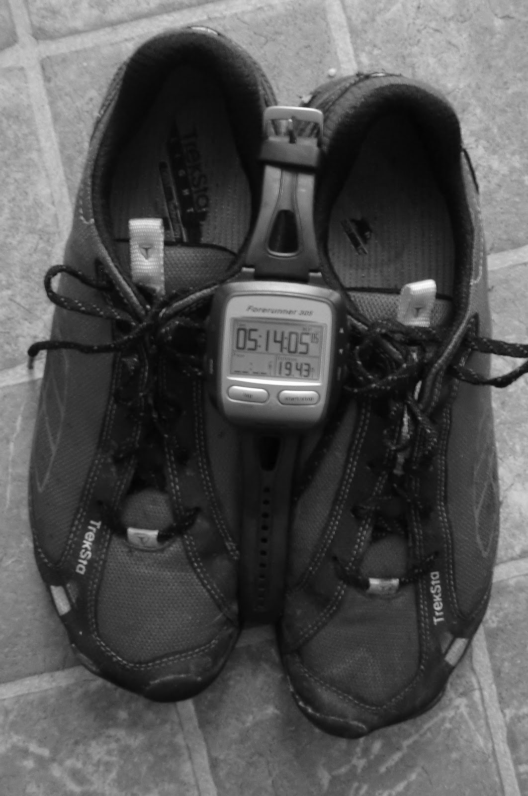
We got back to the car just under 5 hours after we'd left, having whiled away 19.5 miles.


An ever present grin kept me company the whole way home as Mamie snored loudly and contentedly from her backseat roost.  Who knows if we'll be back specifically to visit the General, but we will definitely return to St. Anthony's Wilderness as there is much more exploring still to be done.

----------------------------------

*Over the years I've found little snippets of information here and there on Rausch Gap, Yellow Springs and the surrounding area.  The first half of my childhood was spent in nearby western Berks County and my father and uncle spoke reverently about this part of the state and I always hoped to do my own exploring one day.  After we moved to Lancaster County, I spent much time adventuring closer to home and didn't actually get up to Raush until many, many years later.  While doing a bit more digging in the days before and after this outing, I stumbled on the following page, compiled by J.W. Via, that included several photos, maps and illustrations that I hadn't before seen:  St. Anthony's Wilderness

I'm grateful to have found it and encourage you to check it if you're interested in far more detailed information on the area and its history.

5.08.2012

a day's hard night.

Just before walking out the door of the office on Friday afternoon, I received news that a deadline I thought was 3 weeks away was actually just a week out.  That news hit me like a kick in a place (pick a place) that hurts and hurts a lot.  I wasn't happy to hear it.  Angry, in face and my initial and immediate frustration threatened to fester and destroy my entire weekend.

I fumed for a few minutes, recognized that because of the give-and-take required in the project, I wasn't going to make any headway this weekend anyway, and decided that I was going to take advantage of that fact and have a helluva weekend before settling into the sure-to-be-painful grind on Monday morning.

I went home and found the kids at play in the backyard with one of the neighbor kids and a friend of Lil's from her nursery school.  I tagged in on parent duty, freeing up Lindsay to attend to school work of her own, and spent the next couple of hours performing soccer goalie duties, being a "monster" and chasing the screaming kids from one end of the yard to the next.  It was great.

On Saturday, I played endlessly with the kids and, once Lindsay got home from clinicals, went with the entire family to the carnival in Buchanan Park.  It, too, was great or at least the time we had together was.


We had a wonderful little dinner together on the outside patio of a local restaurant at which all of the other patrons decided to eat indoors.  Having the whole place to ourselves, we laughed and enjoyed each other's company without any of the usual concern for the other diners that can make eating out with 3 and 5 year olds less than inviting.

You guessed it...it was great.

Arriving home as the sun was just beginning to set, I knocked out the mowing (don't EVEN get me started on this country's ridiculous obsession with manicured lawns) while the girls got tubbies (yes, we call baths tubbies) and Linds readied them for bed.

I finished up in time to take over bedtime story reading duties and got the girls tucked into their beds.  I doubt that visions of sugar plums danced in either of their little heads, but they drifted off with smiles that left me certain of sweet dreams to come.

And then...it was time run.

Rumor had it, there was a super moon on the prowl and that meant the promise of brightly lit trails to accompany the warm temperatures.  With Lil and Piper in bed and Linds bound for the same soon, all I had to worry about was being home by sunrise when Lindsay would need to again return to rounds at the hospital.

I rendezvoused with Jefferson a short while later and we carpooled 40 minutes north and east to where the Appalachian Trail crosses Route 325 in Clarks Valley.  This is the same trailhead from which I'd started my Horseshoe Trail 37-miler back in July 0f 2010 and Jefferson had seen me off on that run too.  This time we'd be heading west instead of east, climbing up Peters Mountain and running its ridgeline until we decided we'd gone far enough and needed to turn around and come back to the car.

This so called Super Moon was out, and bright to be sure, but there were plenty of clouds to dull the dazzle of its touted performance.  My romantic wishing for a run by moonlight was definitely going to require the sensible reliability of a headlamp.


Jefferson had had stomach issues earlier in the week that had him wondering about the state of his legs and I was curious if I would feel any ill effects from my climbfest on Mole Hill earlier in the week.  I had hoped to sneak in another run or two between then and now but my schedule had not cooperated.

The only real significant uphill of the night came right away, as the southbound Appalachian Trail sign at the low-lying parking lot on Route 325 points to an 800 foot climb over the next mile-and-a-quarter.  A couple of big step-ups near the end of the first mile reminded me that we intended to go a long way and maybe it wasn't the wisest decision to be attempting to run every single inch of the ascent.  Jefferson didn't protest, hinting that it would've been nice to have a warm-up ahead of a run straight up the mountain.

No such luck, but we were up on top soon enough and settled back quickly into a steady pace.  We talked about life in general (as we always do), our families and Jefferson's adolescent memories of visiting a camp in the valley just below us.  We also discussed the the terrain in relation to the Laurel Highlands trail where we'd be running together in just a few weeks.  I remember commenting that Laurel would have more elevation change but wouldn't be quite as rocky even though, at that point, I was finding the footing far less rocky than what had been the case on my recent miles on sections east of where we were.

The moon was growing less and less super as the night wore on and the clouds won over.  It did continue to make infrequent appearances and I tried to take advantage of its light to snap a few photos.  Through the lens of my camera, the moonlight cast ghostly glow through Jefferson's water bottle.


We also took periodic breaks to make sure that we were refueling, an effort worth making in the warm, humid conditions.  Jefferson's legs had come back and I was feeling good too.  Despite this, the initial climb, the rocky footing and the handful of stops had kept us from doing anything even close to our strongest pace and by the time we stopped at around 7.5 miles to assess the run and how much further we should go, it was well past midnight.

A slave to landmarks and wanting to reach points on the AT from which I can start fresh another day, I had hoped to make it all the way out to the pedestrian footbridge that spans the trail's intersection with Route 225.  This was likely another 2 miles from where we stopped to make our assessment.  Knowing that we'd have a 45 minute drive home after we got back to the car, I'd pretty much decided it was time to turn around.

But...I didn't know our exact location and, being certain that that would bother me in the days after, I suggested that we keep going west until we hit the next recognizable landmark and turnaround at that point.

We blew right past the spur trail that leads to the Peters Mountain shelter without seeing the sign that identified it as such.  When we hit a power line, I knew that we were only a half mile from the footbridge and, both feeling good, we barely hesitated in making the decision to push on.

The parking lot just before the bridge burst into sight somewhere after 2:00 in the morning. The view through the fence that ensures hikers don't topple down onto the road below was eerie in the light of the full moon and again I pulled out the camera and tripod to see what I could manage to capture.


We'd come 9.75 miles and, looking at a good long return trip, we made sure to pound some food and drink before getting back on our feet.  Except for minor stiffness, to be expected with the AT underfoot, we were both feeling fairly fresh.

And we continued to for the next mile or two.

When you do an out-and-back and start wondering why the trail seems so much more technical on the return trip, it's a pretty clear sign that you're getting fatigued.  And I was.  So was my partner and his knees weren't just fatigued but angry.  My feet were getting sloppy and, as can happen when this starts to be the case, I banged the front outside of my left foot hard and awkwardly off of a rock with a poorly timed step.  I hadn't broken anything but I'd clearly bruised myself in a fashion that made certain footfalls painful.

The time to shuffle had arrived.  Anyone who's done any ultra racing or significantly long trail running knows exactly what I'm talking about.  The knees stopped lifting and the feet were coming off the ground just high enough to scoot forward just quickly enough to not be mistaken for walking.  Through a couple of relatively smooth sections, we made decent progress but those sections were frequently interrupted by rocky stretches that demanded a picking of spots that slowed us to a determined hiking.

Despite our ever slowing pace, I was psyched because I knew that we'd already well surpassed the length of Jefferson's prior longest run and forward progress was still happening even if not at the pace with which we'd started.  I tried to keep Jefferson encouraged by keeping him abreast of the diminishing distance between us and our waiting vehicle but I believe that backfired as one of those updates informed him that we weren't nearly as far along as he and his body had hoped.  In hindsight and in putting myself in those same shoes, I should have just kept my mouth shut.

Keeping my mouth shut might have also kept me from the hyper awareness of how dry it was.  The heat and humidity, while not overwhelming, had definitely coaxed both of us into consuming more fluids than normal and with several miles left to go, we were metering out the last few drops instead of drinking our fill.  I daydreamed (nightdreamed?) of the Platypus bottle of water that I'd pulled from the freezer right before leaving home.  I'd talked myself out of carrying it in my pack while we ran but knew it would be waiting when we finally arrived back at the lot.

After what seemed like forever, the trail began a noticeable downward progression and it was obvious that we were in our final descent.  With the finishing line looming, fairly forgiving footing and gravity as aid, I picked up the pace but soon discovered, in looking back over my shoulder, that Jefferson was no longer tucked in right behind me.  I crouched down and waited a few moments for him to catch back up and he acknowledged that his knees were not going to let him pound away on the downhill.

Coming up out of my crouch, I realized that my quads and calves had a bit of the just-about-to-cramp feeling and, knowing that the car was close, I was quite content to take the time we needed to get down without pushing the pace or are luck in that last mile.

We made it, of course, and the water was just as cold as I'd imagined it.  We'd knocked out nearly 20 miles beneath the less-than-super moon and, in spite of the fatigue, I'd enjoyed the several hours that Jefferson and I had spent together.


I walked through the door of my home at ten of 6:00, just in time for Lindsay to wake up and head to clinicals.  An hour or two later, Lily and Piper roused me from a dead-to-the-world sleep in search of breakfast.  That was all the sleep I was going to get until later that night but I had no interest in cutting into Daddy-time because of my late night.

Thankfully, the girls didn't need to me to do anything more than shuffle as we played our way through the rest of the day.

7.28.2011

horseshoes and....

Been running the Horseshoe Trail now pretty religiously for going on two years and have been itching to venture out onto more of its 120+ miles.  I've also been anxious to go beyond the 50K distance in anticipation of taking a shot at 50 miles later in the year. 

With my 37th birthday arriving on July 25th, I set my sights on running the last or first (take your pick) of the Horseshoe Trail the day before said birthday.

Lindsay had to work a shift at Lancaster General, but my mother and stepfather agreed to watch the kids until I could get to them.  Jefferson selflessly agreed to shuttle me from a car drop in Campbelltown to the Clarks Valley of the Appalachian Trail, the nearest access point to the yellow blazes of the Horseshoe.  The week prior brought one wicked heat wave and I considered calling off the run, but Sunday's weather report was a little less ominous with temperatures dipping back down below triple digits.  The humidity was still going to be an issue, but the plan was a go.


Things got off to an inauspicious start when I couldn't find the Locust Street the Horseshoe Trail guidebook told me I needed to travel in Campbelltown to drop the car.  I ended up flagging a police officer who was as sure as he could be that there wasn't a Locust Street in town, but, thankfully, he did guide me to where I wanted to be in spite of the missing road.

With the van parked, I jumped in with Jefferson and we headed north.  Clarks Valley is situated in a natural gap between Peters and Stony Mountains and the trailhead put us 3.2 miles from the summit of Stony and the junction with the Horseshoe Trail.

We snapped a quick photo in front of the AT sign at the Route 325 crossing but my fat head managed to block out all but the arrows.  Notice the haze hanging in the distance.  It was right around 7:30 AM.


There's a solid 1,000 feet of climb up to the top of Stony Mountain and I enjoyed the heck out of every step.  Jefferson and I chatted as we climbed the rocky track, making good progress but managing pace to hopefully keep me from bonking later in the day. I wasn't planning to "race", not by a long shot, but I still intended to be running (shuffling, at least) late in the day.

I was having such a good time, I couldn't believe how quickly we seemed to cover those initial miles.  Jefferson snapped another photo of me standing in front of the initial blazes of the Horseshoe and the Cyrus Sturgis Monument.


The run down from Stony was super quick and I wrestled over whether to open the throttle and blast down the ridge or put on the brakes to save the legs.  I compromised somewhere in between and had soon covered two miles of downhill and started down the unpaved Ellendale Stagecoach Road which seemed to go on forever (somewhere around 3 miles, per the guidebook) since I wanted badly to be back on singletrack.

That was going to have to wait.  Much of the 4 mile climb up from Stony Creek to the top of Second Mountain followed a wide abandoned logging road.  Tantalizing narrow trails shot off in all directions and I made a note to come back here to backpack and camp.  The sun was still behind the clouds but the day was beginning to warm up.  Though the inclined grade wasn't too severe, it didn't offer many breaks either.  I was caught from behind by one fiercely fit mountain biker and passed a single trail runner headed the opposite direction who looked spirit-crushingly fit.  I was somewhere around 10 miles into the trip and fighting the first wave of doubt.

Within a mile of the summit, the trail switchbacked against the logging road and transferred to extremely steep singletrack.  I couldn't make out the top and, like it has too many times before, my stomach began to raise protests.  Thankfully, those rumblings never turned into anything, but for a moment they did add to my concern.  Shaking them off, I power-hiked to the summit and sat for a moment to catch my breath, down a gel and consult the book.


It was cool to be doing this solo, but without aid stations waiting down the line, the only water I could count on was what I had in my pack.  The early sections of the route were proving really remote and I wondered where I was going to fill the emptying four bottles (two handhelds and another two in the side mesh pockets on my pack) that I had with me.  A peek ahead at the trail directions didn't look terribly promising.  I decided to start rationing and concentrate on just getting further along the route.

The next six miles were pretty sweet, weaving through mature woods on a slow clamber down from the summit of Second Mountain.  When things leveled off, the path fluctuated between singletrack and logging roads.  There was still little sign of civilization and the few structures that did appear were either in states of disrepair or spartan in their design.  Heavy tree cover coupled with the continued cloud cover to keep heat manageable.

In Manada Gap, the trail vanished into road but showed no sign of a place to replenish fluids.  The guidebook suggested that a mere 3 mile detour (one way) would get me to a convenience store but that mileage tack-on seemed really foolish and the whole idea of leaving the Horseshoe felt really unappealing.  I ignored the offer and stuck to my yellow blazes.

Less than a mile later, the trail reappeared and followed what the guidebook had referred to as a "beautiful trout stream on a splendid woods trail under old beeches and hemlocks".  The trees were still there (though I suspect in fewer numbers) but there wasn't enough water to support trout and the trail itself appeared to be woefully untraveled.  Bummer.

Another bummer was being completely out of water, especially when the trail vanished again and the blazes migrated from trees to telephone poles.  I was back on the road again and less than thrilled by the exposure to the sun.  The New Balance MT101's that I was wearing were spot on for the trail, but not ideal for extended road work.  Wah-wah.

I decided I would offer cash to the next human being I saw in exchange for cold water in my water bottles.  Over the next 3 miles, however, I saw plenty of homes but not a soul outside.  The whirring of air conditioners and the periodic appearance of undrinkable backyard swimming pools mocked me and my bone dry bottles.  Help would eventually come in the form of James who was outside braving the heat to deliver water to his landscaping.


James wouldn't hear of my offer, turning down the cash while kindly taking my bottles to fill me up with water on the house.  Perhaps because I mentioned that I'd come the whole way from Clarks Valley, he even filled me up on ice.  I couldn't have been more grateful, though I'm not sure I properly conveyed this, as stopping at last made me acutely aware of how parched and hot I'd become.  Looking back towards the distant aridgelines from his front yard, I got my first sense of how far I'd come.

I said my thanks and offered goodbyes before chugging back down the road.  My spirits soared for a few minutes until I started to get the feeling that I may not find dirt under foot for a good long while.  I was 21.5 miles into my run but feared it might be road the rest of the way.  The sun was now unimpeded with the clouds having melted away and I was taking a pounding. I realized I'd only had James fill up two of my bottles despite his offer to top off anything I had.  Dumb.  Those two bottles were only going to go so far.

As I reached Route 22, I hung a left in hopes of soon finding somewhere to get more water.  My confidence was wavering, my left foot was hating the road surface and I was really starting to dread the idea that the trail running portion of my day was over.  Stumbling upon a closed-for-the-day garage that had a stunningly beautiful soda machine parked right outside, I sat down to drink an ice cold Pepsi and ponder the possibilities.

I fished my cellphone out of my pack and attempted a call to my cousin, Chad.  He didn't answer the phone.  I replied to a text message from Jefferson asking how I was holding up and asked him yet another favor, this time hoping he could Google Route 22 East and tell me where it ended up.  While waiting for his response, Lindsay called and gave me an earful about a minor calamity at home.  I raised my voice back at her before we both calmed down, offered deserved apologies and traded "I love yous".  From there I placed a call to Mom who confirmed for me that 22 wasn't going to take me where I wanted to go.

I collected my thoughts, scoured the various maps in the Horseshoe Trail guidebook and decided it was time to quit mucking around and get back to what I'd set out to do in the first place.  Yes, I was hot and was looking at a lot of roadwork, but my legs felt pretty good and my stomach was fine.

I finished the last of that oh-my-god-good Pepsi and bought a number of waters from the machine to refill all four of my bottles.


I texted Jefferson to call of the Googling and confirm that I'd gotten my head straight.  Sending that text was the final push I needed and I was back on my feet, heading west to reconnect with the Horseshoe.  It wasn't long before I'd managed to do just that.

I covered another 6 miles before the blazes again got me off of the road, dumping me into a farmer's field somewhere around 27 miles into my day.  There was a confusing twist shortly thereafter when the trail seemed barred by a tall cornfield.  That proved a good thing because it forced me to again consult the guidebook which encouraged me to look back across Swatara Creek toward the Blue Mountains for "one of the most remarkable views along the trail".  I haven't seen enough of the trail to properly validate that claim but it sure was lovely.  The camera failed to capture a proper image through the afternoon haze, so I did my best to save the view to memory.

Turning back to the task at hand, I plowed through the cornfield and came out running on the other side.  A bright yellow blaze was waiting for me and waved me down the trail.  Sadly, that lovely bit of trail lasted little more than a mile before depositing me back onto roads just north of Hershey.  Before it did, however, I was offered one last look back at the mountains and this time the camera cooperated with a fairly nice representation.


I passed by Hershey Cemetary (the venerable Milton Hershey is buried here) and endured a rather frustrating bit of "where now?" in an old inactive quarry that added a few hundred unnecessary yards to my journey. Emerging finally on the other side of that stretch, I had less than 10K to go.


That was good news because I was tiring.  I threw a pose at the sun to see if I could spook it back into hiding but my bluff was called.


There was one last bit of confusion to muddle through before I got where I was going.  It could've proven disastrous.

Per the guidebook, I'd soon arrive in Palmdale, cross 422 and then make my way to Campbelltown.  I'd never heard of Palmdale but hadn't given it too much thought.  At this point, though, I had a pretty good idea where I was and where I was was Hershey not Palmdale.  A bit more searching in the book uncovered a reference to Palmdale being a "western suburb of Palmyra".  Palmyra I knew and Hershey I knew.  I couldn't tell you where one ends and one begins but I do know there isn't a Palmdale in between.

Not anymore.

Upon reaching 422, I flipped a mental coin and hung a right.  A mile later, I began to doubt my decision AND discovered that I was again out of water.  I backtracked a bit and ducked into a restaurant/bar.  Evidence of my running out of gas is the fact that I never even took any notice of the name of the establishment.  Poking my head inside, I pleaded with anyone available to clue me in on Palmdale and the seemingly fictitious McKinley Avenue.  No one knew what I was talking about and, frankly, I soon realized how insane I must have looked, sporting a cavemanish beard, wearing a sweat-drenched backpack, clutching empty water bottles and babbling on about a town that didn't exist.

A young guy named Dustin came to my rescue, throwing my beard a compliment and fetching me a Coke.  He also filled up one of my other water bottles which was huge and even retopped off my Coke after I downed it in about 3 seconds.  I bounced the Palmdale/McKinley question off of him but he too did not find either of those references familiar.  When I mentioned that I was heading to Campbelltown, he felt pretty certain that I needed to head east and hang a right.  In terms of getting me to Campbelltown, he was correct but I actually needed to push a little farther in the initial direction I'd headed to pick up the Horseshoe Trail.  Honestly, it mattered little at this point because I was looking mostly at roads regardless of which way I went.

Long story short, Dustin gets props from me for getting me exactly where I asked him to get me and for just being down to earth and cool at a moment when I benefited from that at least as much as getting the "right" directions.  No props for me in failing to snap a proper documentary photo.

And so I made it at last to Campbelltown, though I was approaching the van from the wrong direction and from off the "trail".  I'd been pretty sloppy with the GPS throughout the day, often turning it off when I took breaks but not always and sometimes forgetting to rehit "start" when setting off again.  I'm certain that I'd gone at least 37 miles by the time I opened the door, but the Garmin said 36.55.  I put my pack and bottles on the passenger seat and kept on running, heading out along the Horseshoe Trail along the route I should have just been on.  After about a quarter mile, I spun on my heels and returned to the van.  My day was done and my MT 101's could wait for dirt.


Happy Birthday to me.